
For Mac, iPhone, and iPad
A live map of aircraft and APRS, from the receiver you own.
Pair it with a Raspberry Pi receiver and follow traffic with no internet at all.
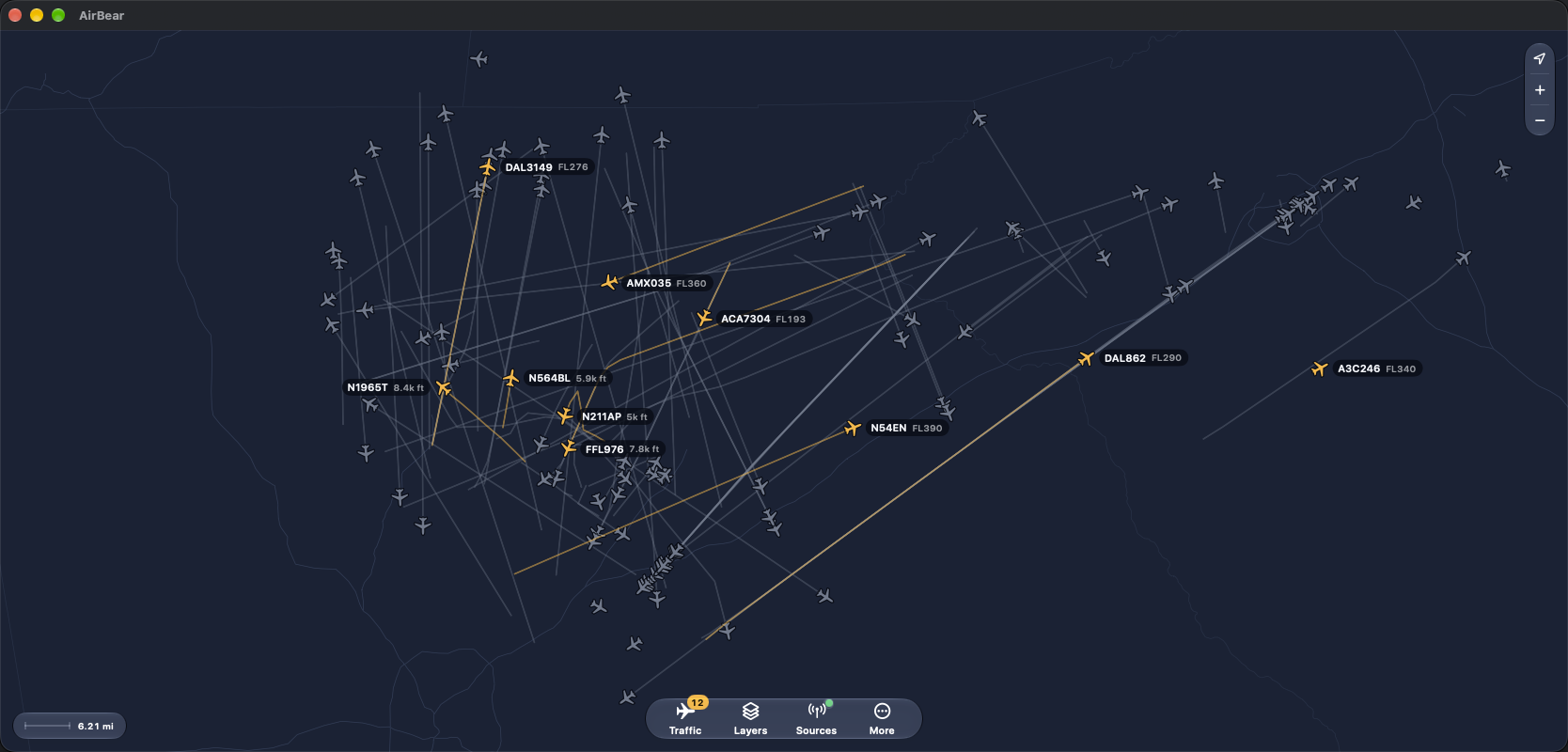
Aircraft and APRS
Aircraft broadcast ADS-B every second or so. Each message carries the callsign, position, altitude, speed, and heading. AirBear draws an airplane pointing the way it is flying, labelled with the callsign and altitude, and a trail of where it has been. A good antenna with a clear view of the sky hears aircraft 100 miles away.
Amateur radio operators use APRS to share positions on the 2-meter band. AirBear shows cars, hikers, weather stations, high-altitude balloons, and the relay stations that pass it all along. Each station is a dot with its callsign, plus its speed when it is moving. You need an amateur radio license to transmit, but not to listen.
Tap any aircraft or station for its altitude, speed, heading, distance, and position. Follow keeps it in view as it moves. When you are online, a link opens it on FlightAware, ADS-B Exchange, or aprs.fi. AirBear also shows your own position, from the device or from a GPS on the receiver.
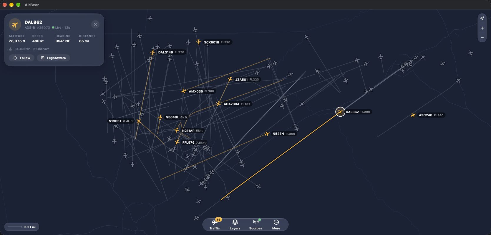
Your own receiver
Flight-tracking websites combine what thousands of other people's receivers hear and send it over the internet. AirBear shows what your own receiver hears, directly.
It does not need the internet at all. AirBear connects to the receiver over your network, or by Bluetooth within about 30 feet, and it has its own map of borders, roads, and airports. Take the receiver in the car, to a campsite, or out to the airfield, and the map works the same way it does at home.
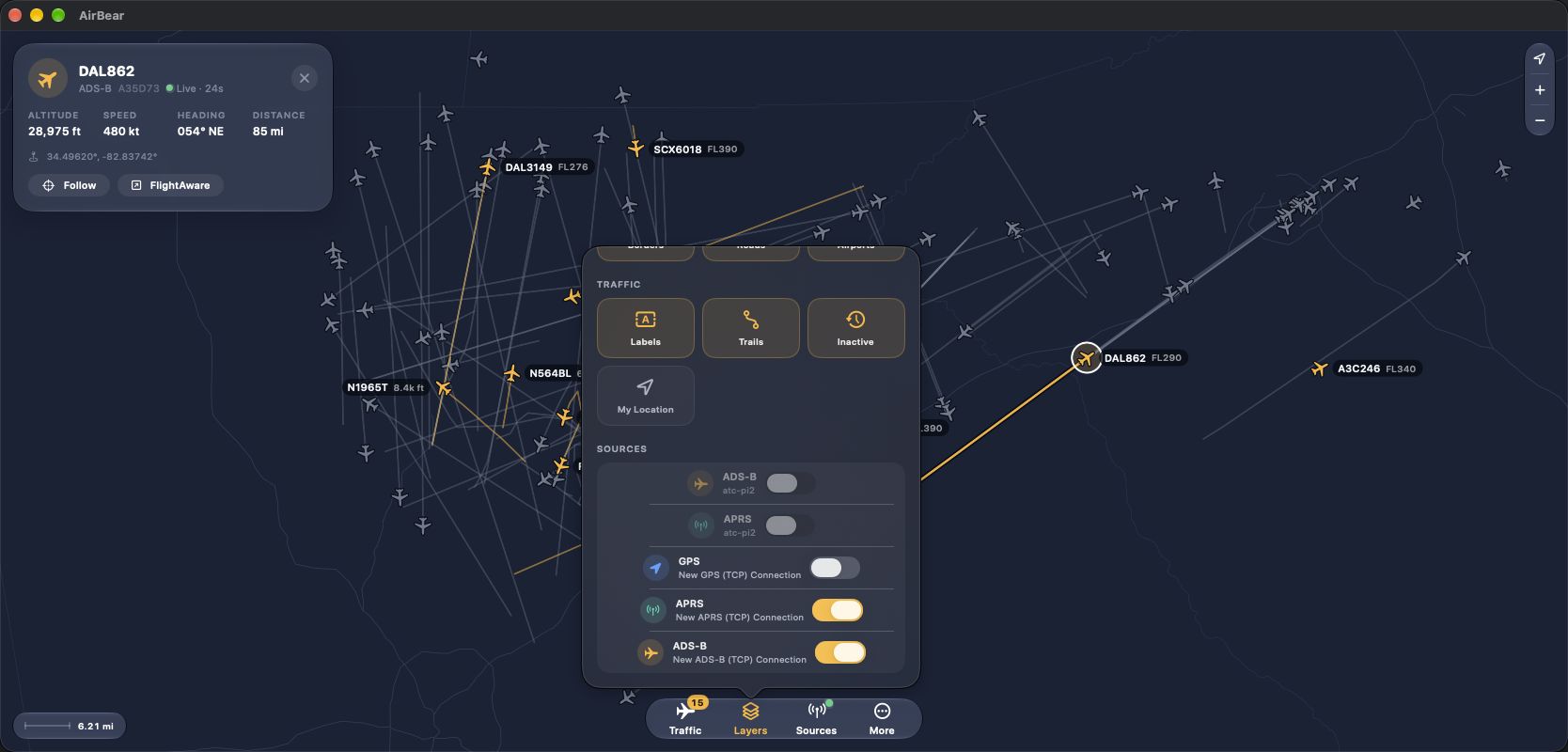
Traffic lists everything the receiver has heard. You can search it, show only aircraft or only APRS stations, and sort by nearest, most recent, name, or altitude. Layers turns borders, roads, airports, labels, trails, and traffic that has gone quiet on and off. Airports are drawn down to their runways and taxiways. Sources shows each receiver and how its connection is doing.
The map turns dark or light to match the device. On a Mac, the Map menu has keyboard shortcuts for zooming, finding your position, and opening each panel.
What you need
An iPhone, iPad, Mac, or Apple Vision Pro, and a receiver you own.
- A Raspberry Pi 3, 4, 5, or Zero 2 W.
- An RTL-SDR USB dongle with a 1090 MHz antenna, for aircraft.
- Optionally, a second dongle with a 2-meter antenna, for APRS stations.
- Optionally, a USB GPS, if the receiver travels with you.
Setting up the receiver takes one command, and removing it takes one more. Set Up Your AirBear Receiver walks through it.
If you already run readsb, dump1090, or Direwolf, AirBear reads aircraft from SBS (port 30003), APRS from Direwolf's KISS port, and position from an NMEA GPS feed.
Platforms
Mac · iPhone · iPad
Where to get it
Download AirBear from the App Store, or take the Mac zip. There is a TestFlight link. Set Up Your AirBear Receiver walks through the Raspberry Pi.